Only an hour and a half away, in Keizer, Oregon, was the one and only In-N-Out burger in the entire state. The mecca of burgers.

For the holidays we’ve been making our way down from Oregon to Southern California to be with family, and I’d also been invited to be a print competition judge for a professional photography group in San Diego the first week of November. So the trip down was not going to be quite as leisurely as it had been up to this point. Our midway point near(ish) central California was in an area somewhat near Salinas, but more inland. Hollister was the closest town, and we are talking pretty much in the middle of nowhere here. It’s not in Bumf*ck, but you can see Bumf*ck from there. The issue was planning the continued route south. We needed to head over to the 5 freeway, and we’re quite a bit closer to the 101. Apple maps presents two options. Both show sort of equal in time, but one backtracks us a distance back north, then back down the 101 south to a road that crosses over, and the other just crosses over to the 5 from almost where we’re at, with only a very short drive north first. This is key… on the map, they look pretty similar. Just east/west roads that cross from the 101 to the 5 freeway. So, of course I choose the closer road without the long drive north, and our trip down Panoche Road starts. I will say this in my defense. It was the much more interesting choice.

At first, and for quite a while it was just a normal rural road, one lane, narrow and kinda rough in places. then it started to get real winding, with many very narrow spots with lots of climbing and downgrades. We drop from 40 mph down to 20, then down to maybe 10. The shortcut is not short. After miles and miles of this, we hit the sign:
Road Ends
Impassible when wet

Yeah. That sounds bad. We’re 50 miles and 2 hours into this “shortcut,” and now the road turns to dirt and sparse gravel. Did I mention that there was no cell service on either Verizon or AT&T for almost all of this road? This is a problem. On the map, (which was cached,) it showed we were three quarters of the way through. It hadn’t rained in at least a week or longer as far as I knew. We’ve driven dirt roads many times. I’m all for pressing ahead. The navigator, on the other hand, is a bit past freaking out and headed towards rip my head off. Discussions ensued. We headed on. Not happily.
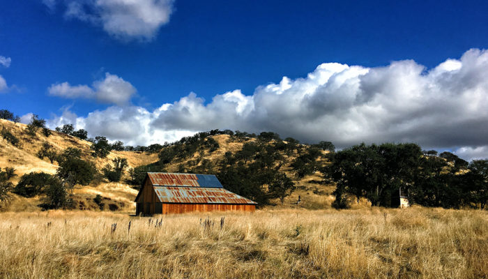
I wish I could describe this road and countryside adequately. Mostly just empty, desolate space filled with roughage and a very winding dirt road cut through it. Tight, twisty paths through lonely canyon cliffs and deserted vistas. Sometimes a remote sort of farm or spread off in the distance. At one point we hit a cavalcade of parked trucks and heavy machinery with a running helicopter nearby and a large tableau of dudes, and one lady with big binoculars, standing around in a circle having what looked like a heavy discussion. They were literally the only people or vehicles we’d seen in 30 or 40 miles.
When we hit the water crossing is when the tension really kicked up a notch. A stone culvert, filled with water, maybe 10 feet across that looked to be about a foot, maybe a foot-and-a-half deep at the most. My biggest regret is not stopping to get a photo of this. In the moment, I felt like if we stopped, a much bigger and much longer discussion would ensue, and honestly, it did not look that deep. So after a brief pause, I went ahead through it… and, it was uneventful. This time. In hindsight, I would be a little more cautious with this should something similar ever present itself. (And at least grab a couple shots before crossing.)
The water-crossing is in the rear view mirror, but the primary problem remains, we are still on this damn road! And, if anything it’s even more winding and desolate. We’re at least 3 hours – going on 4 – into this “shortcut” and no end in sight. Finally, finally, we see another vehicle. A very late model Mustang is moseying along in front of us headed the same way. Yay! I take this as a sign we are approaching civilization again. Another 20 minutes or so, (remember, we’re probably doing 8-10 mph at best) and we see shooters heaven. Still dirt road, but a number of areas off the side of the road that look to be local ammosexual hangouts. We’re seeing AR-15’s, rifles on tripods and sandbags zeroing in scopes, handguns galore and they are all burning rounds. We’re surrounded by flying lead, but at least I know we are on the way out. Sure enough, a few miles later we hit blacktop and just a mile or two after that the on ramp to the 5 freeway. See, that wasn’t so bad! (ducks)
Basically, the long, slow scenic route through desolation, dirt, gunfire and really beautiful skies. A ride like that requires a warm beverage after.
And we’re moving on to Acton, CA.
Related Posts


This Post Has 0 Comments